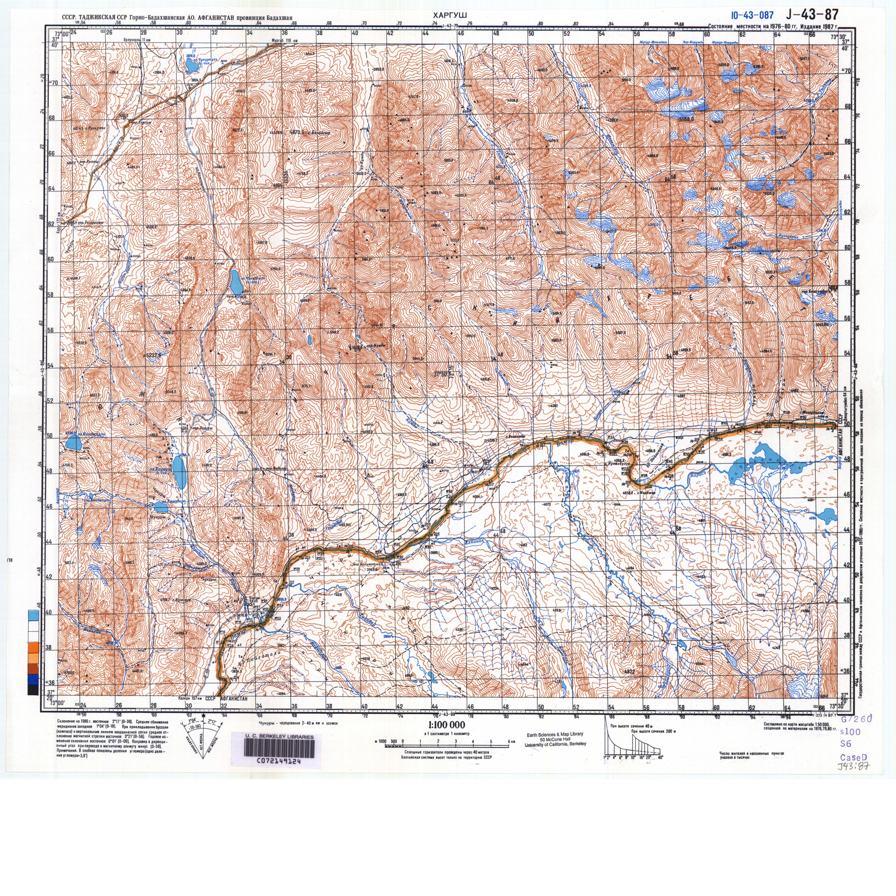
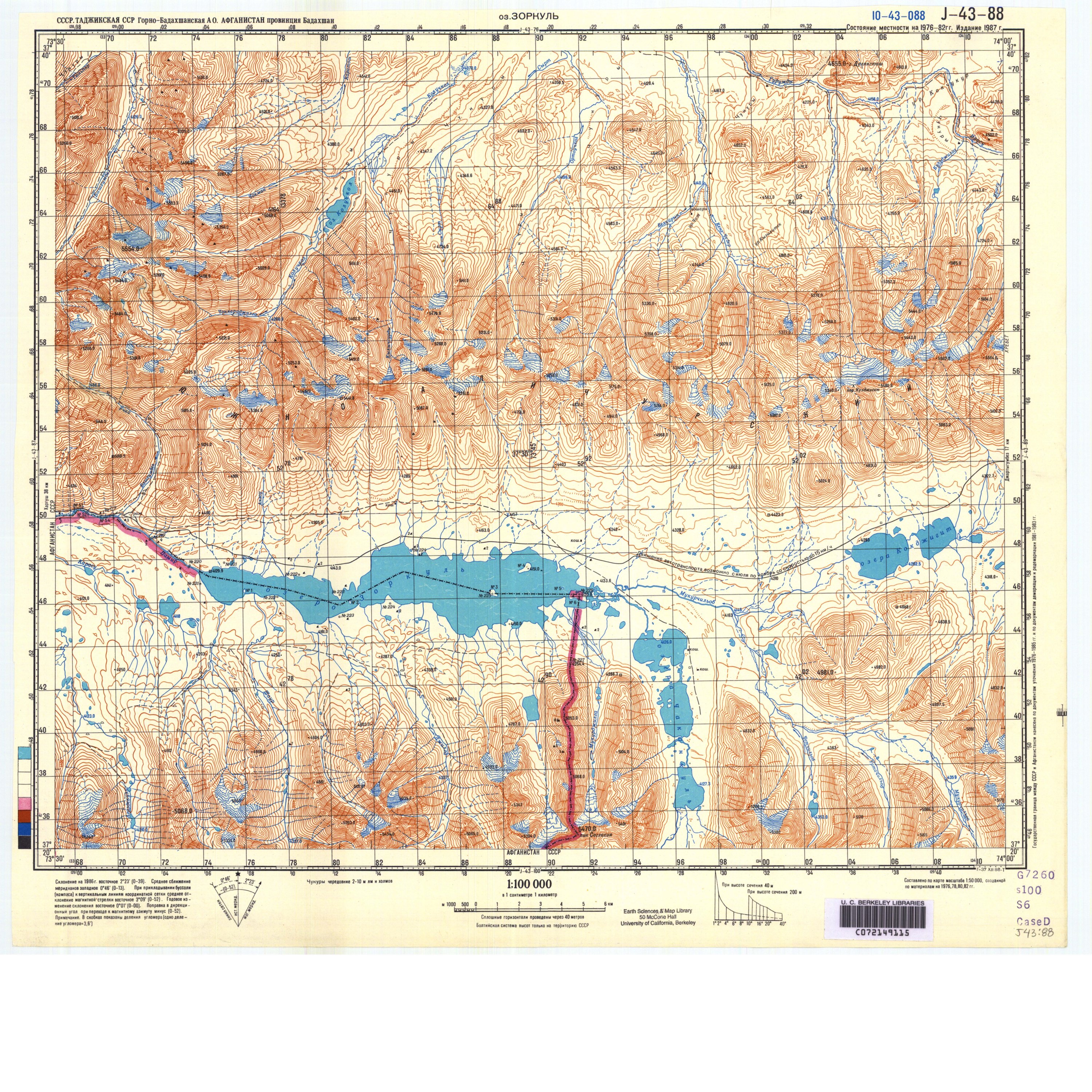
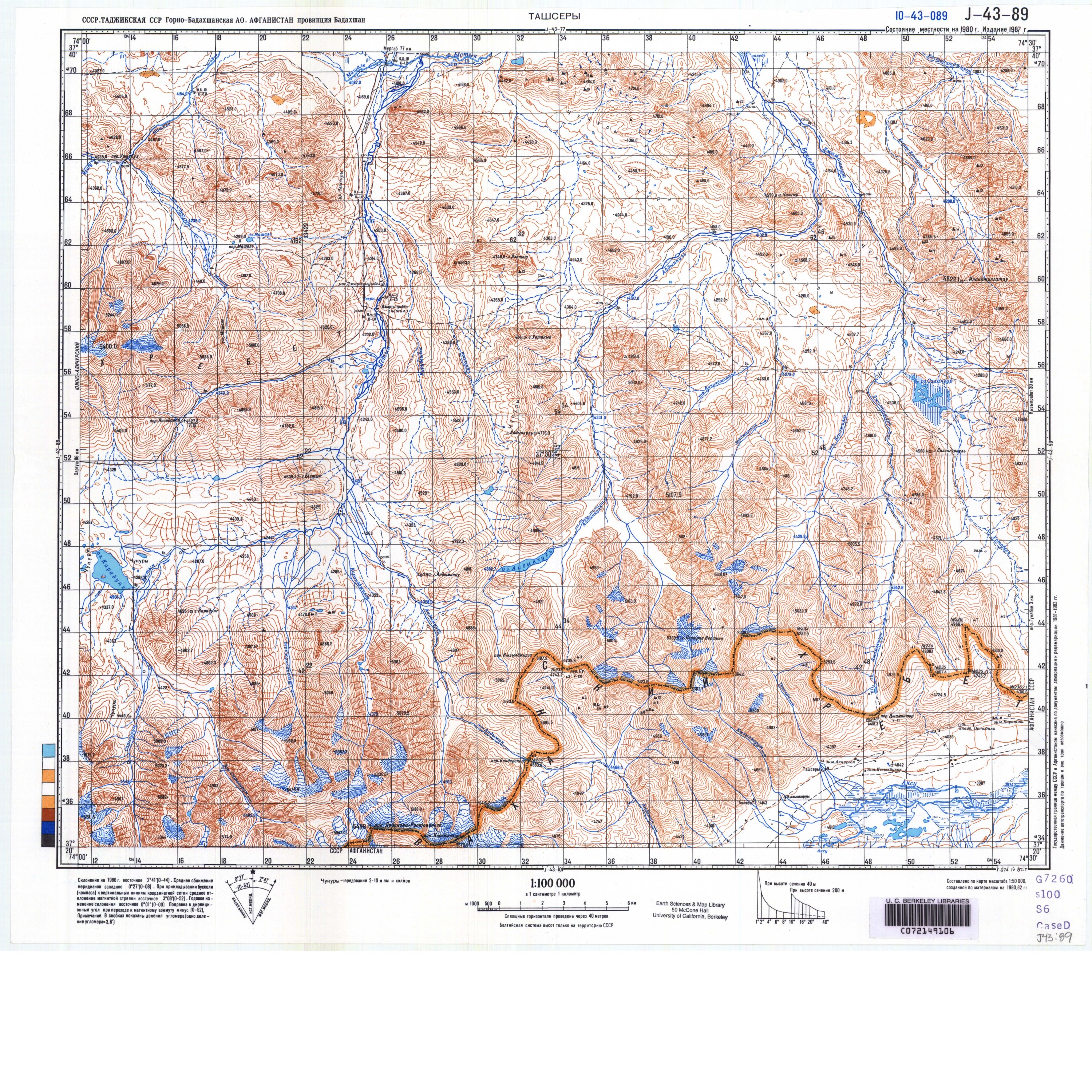
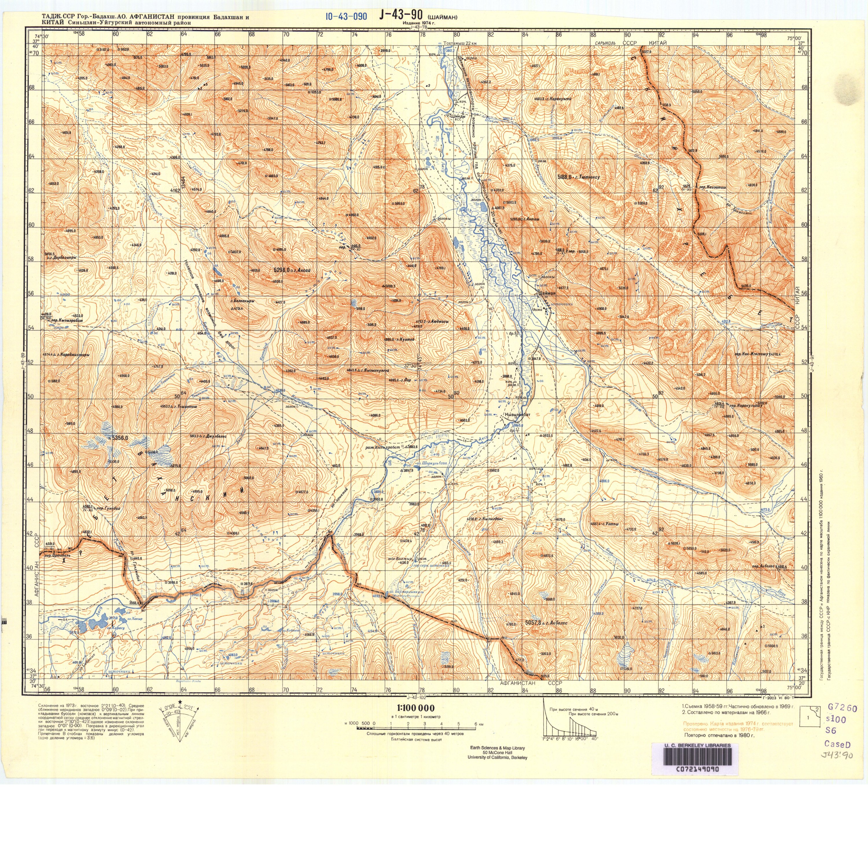
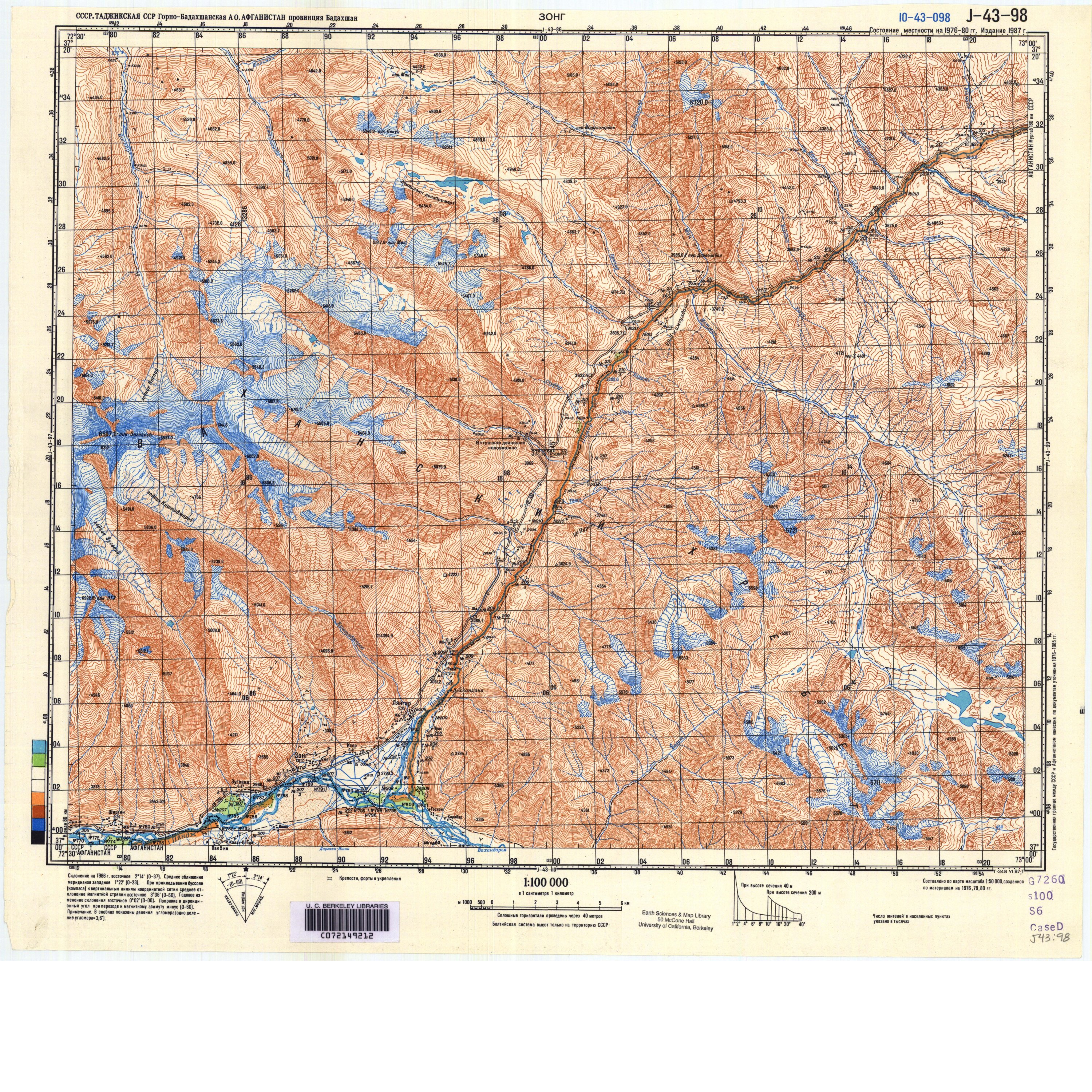
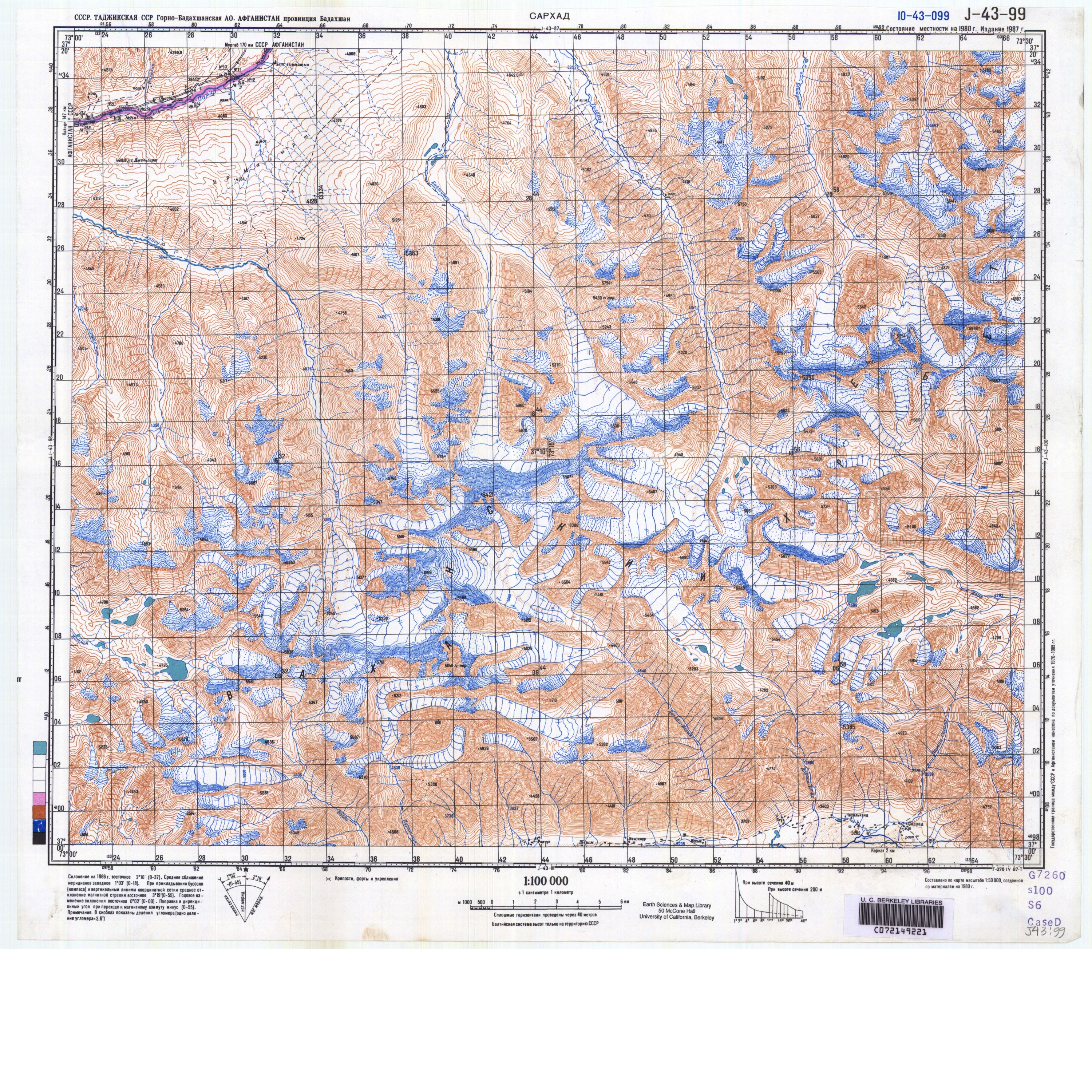
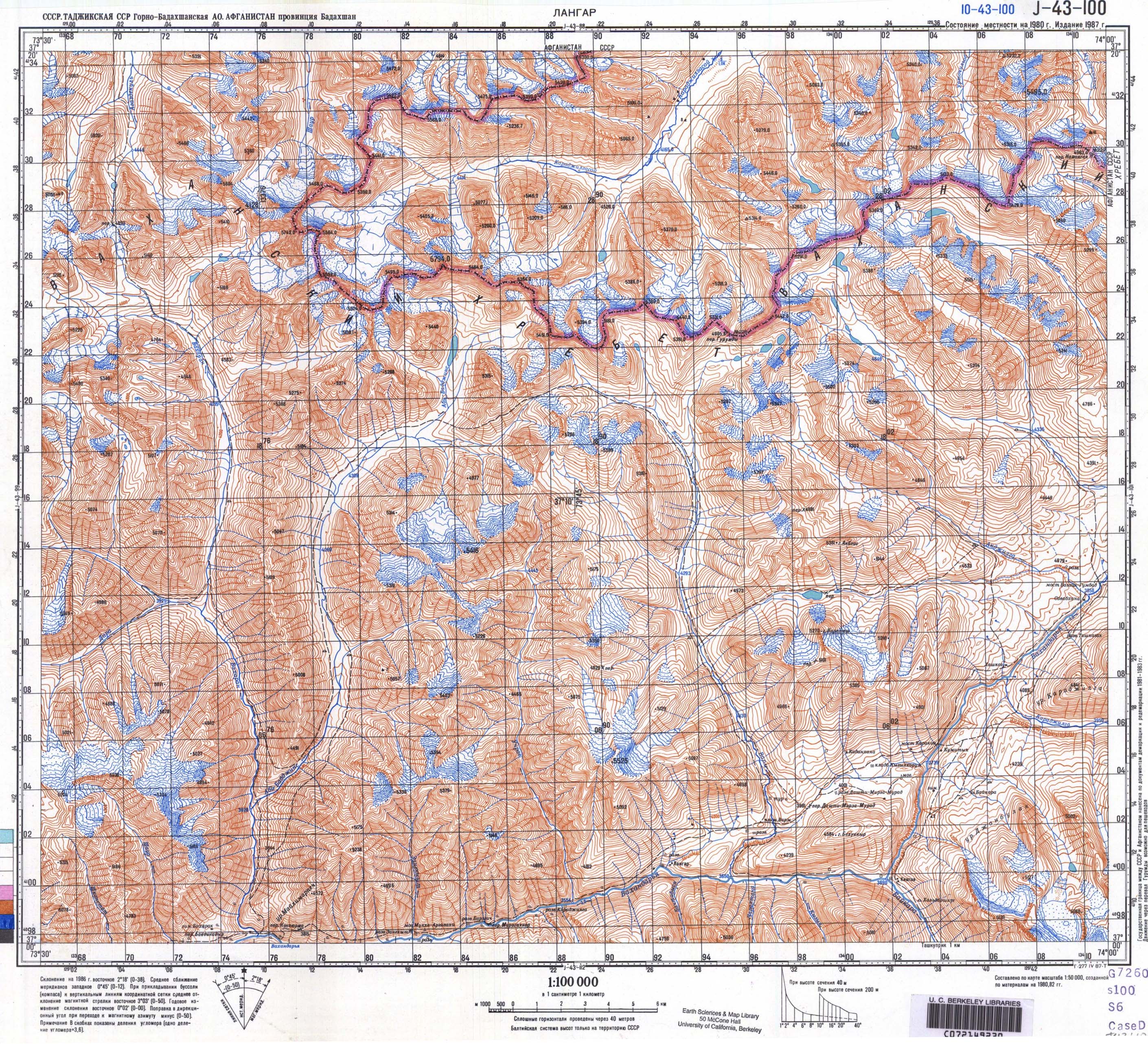
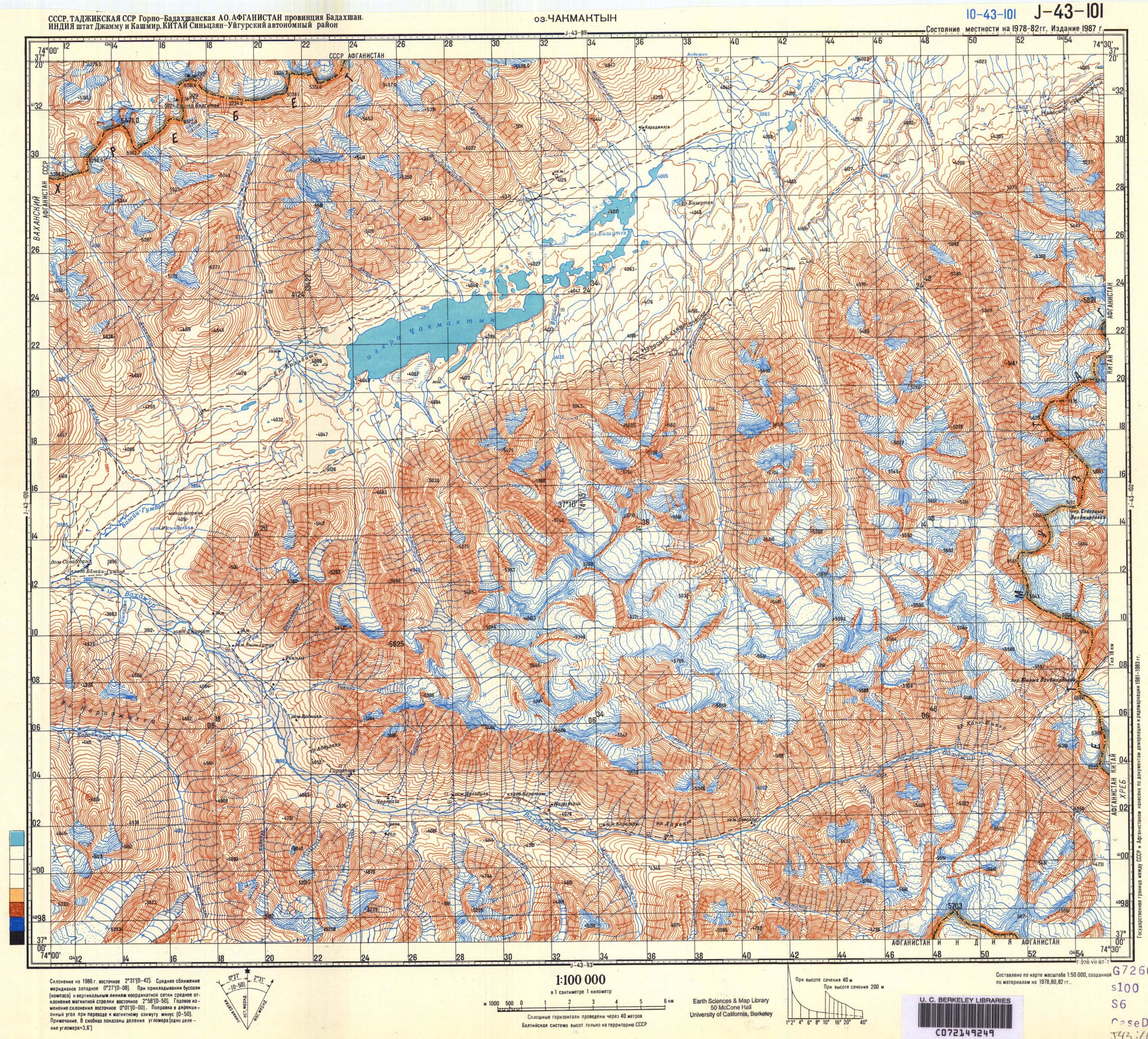
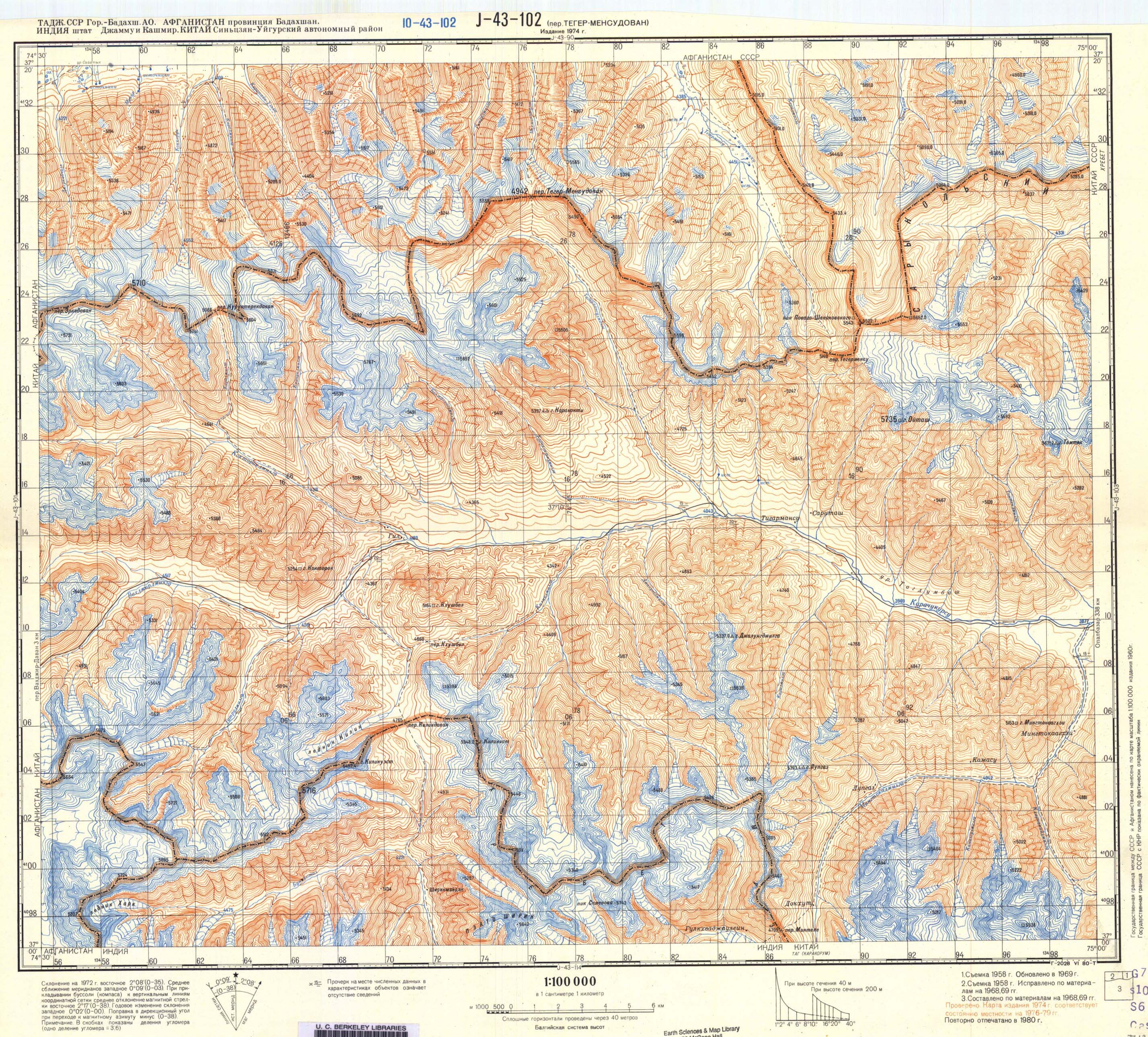
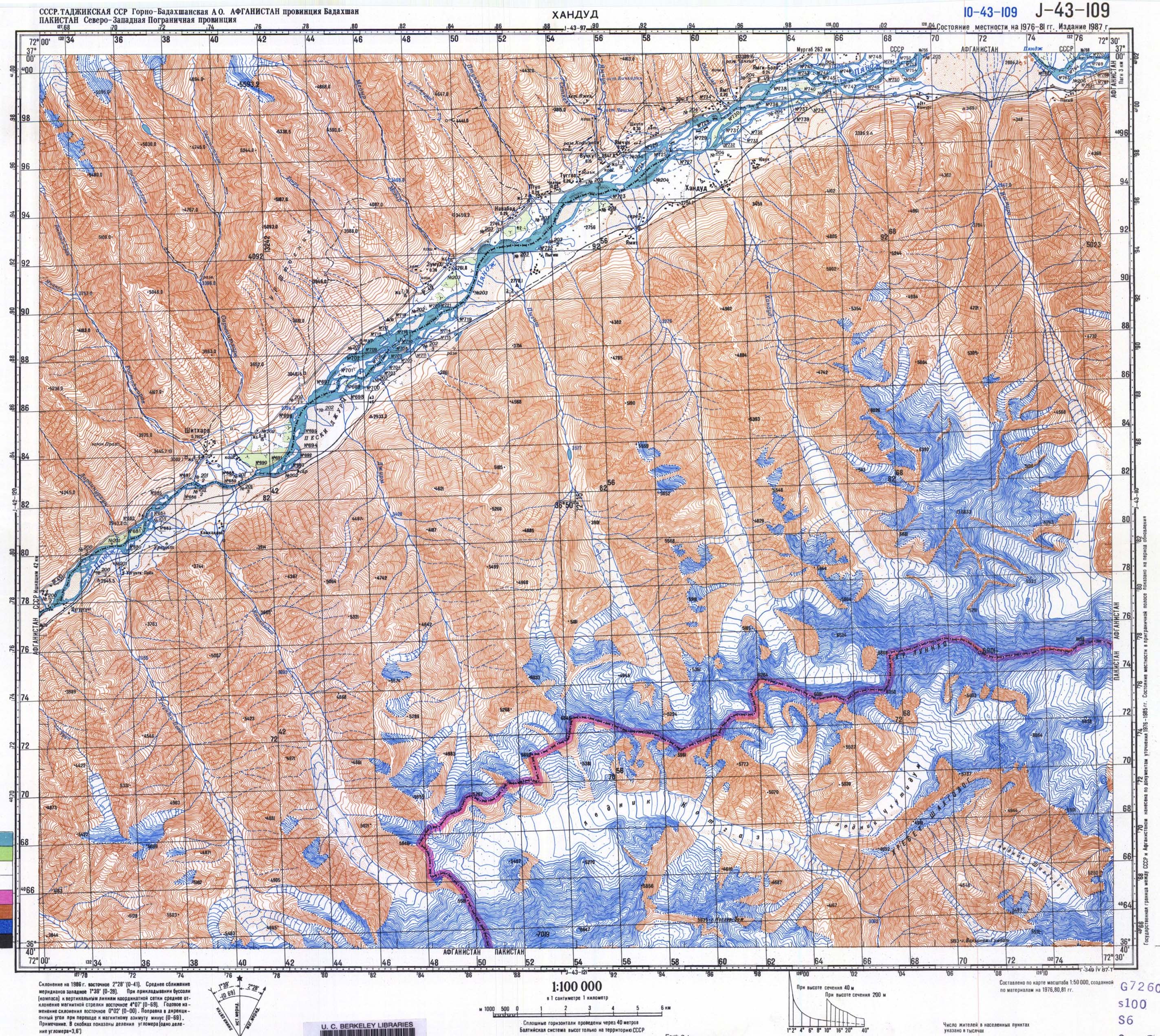
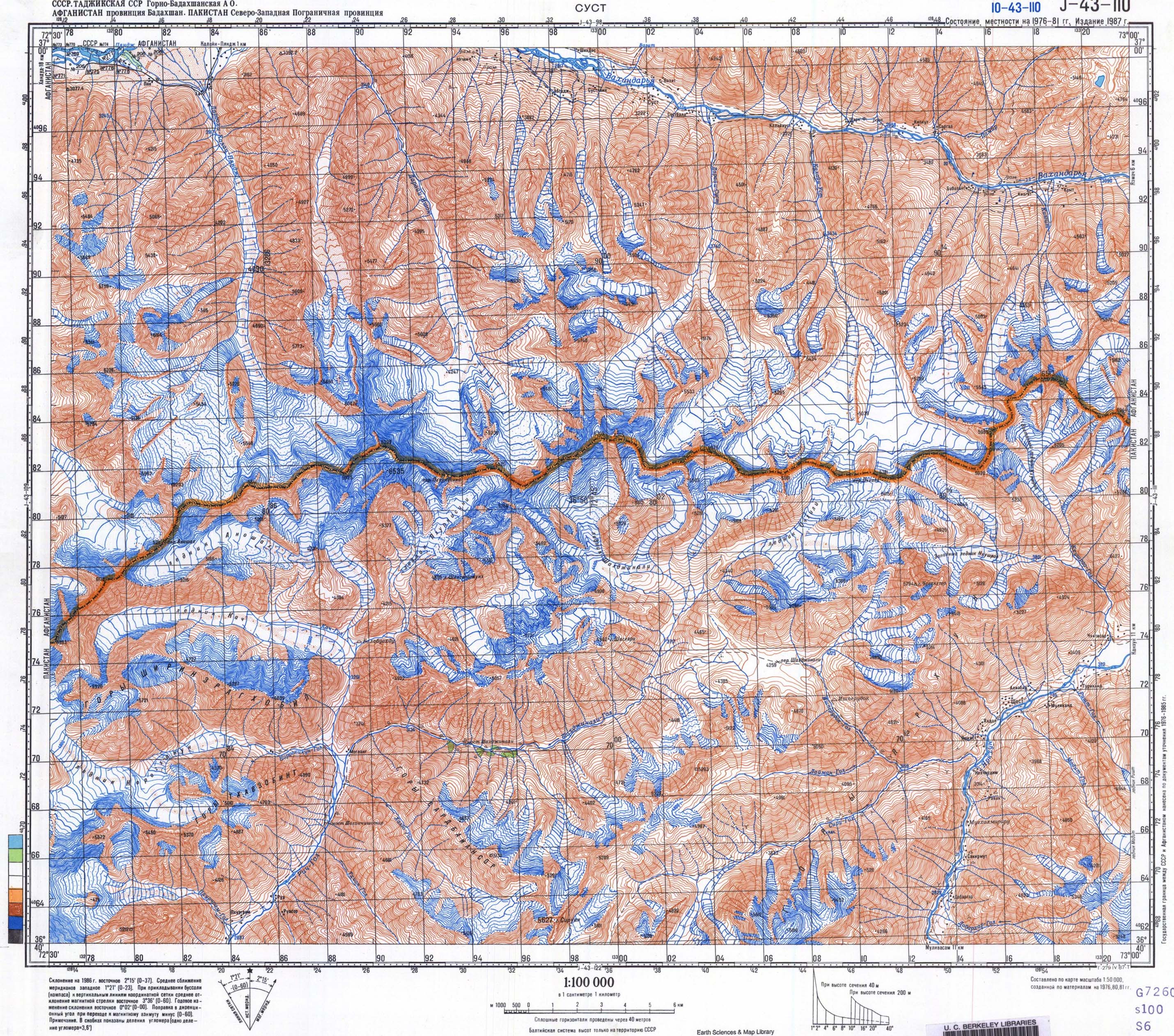
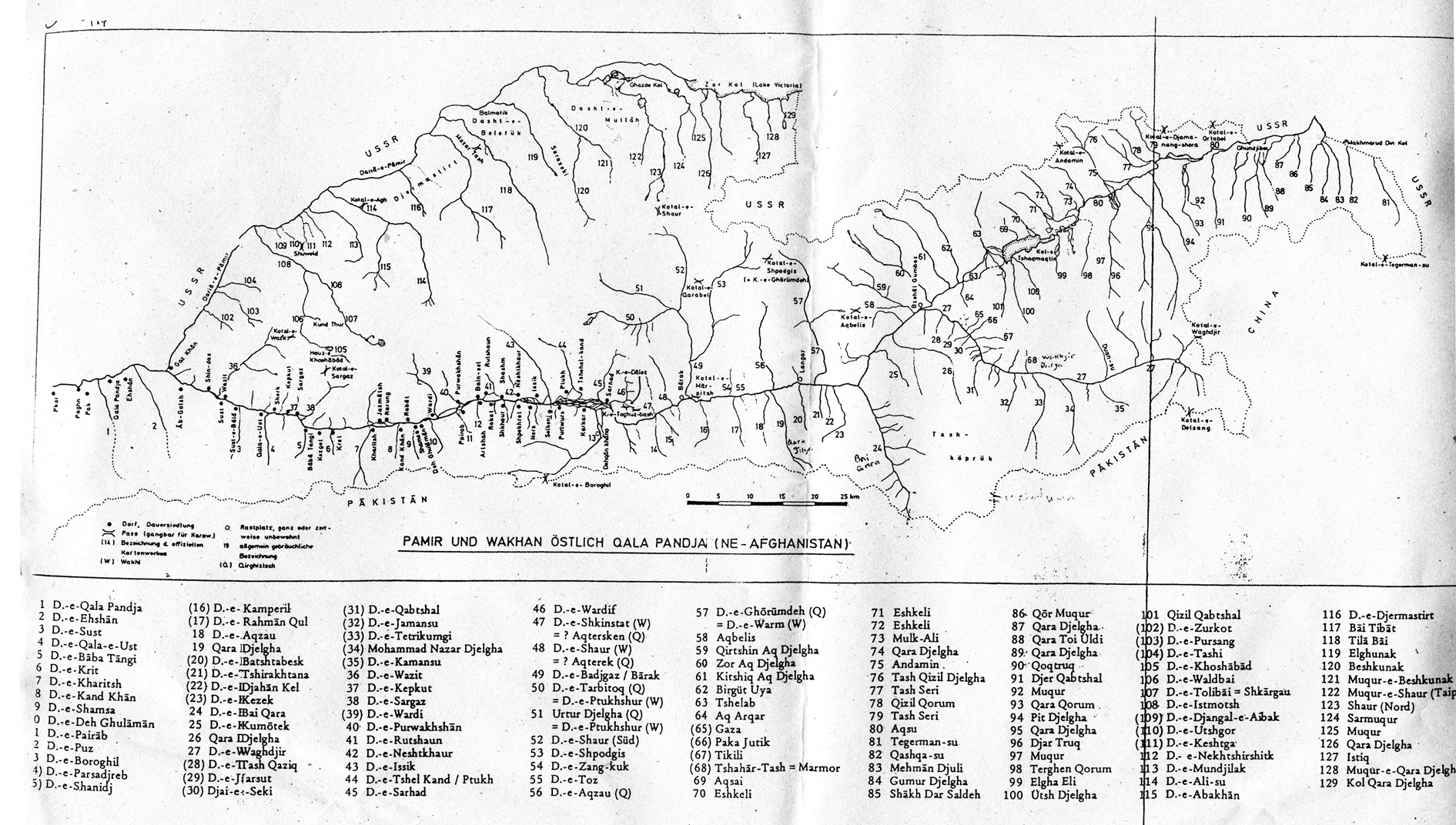
One of the most comprehensive maps for the names of places is the sketch map called Pamir und Wakhan Ostlich Qala Pandja (NE-Afghanistan) from
Die Kirghisen Des Afghanischen Pamir, a book by Austrians Remy Dor and Clas Naumann published in 1978. This sketch map included many local place names in the Wakhan and Pamirs - including all the side valleys. It may be found here.
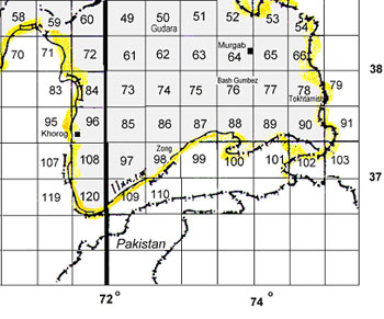
According to John Mock and Kimberley O’Neil, the U.S. Geological Survey (USGS) publishes a seven-map series, the 1:500,000 Pakistan Satellite Image Maps. Two of these maps, N.W. Frontier Pakistan Map I-2587-B and Northern Areas Pakistan Map I-2587-C, show most of Afghanistan's Wakhan Corridor and Little Pamir, including the Wakhjir Valley, and the adjacent areas of Pakistan. Also, the U.S. Defense Mapping Agency's topographic maps for pilots (the 1:500,000 Tactical Pilotage Chart (TPC) G-6B and G-7A) may be proved useful.
According to Afghanistan – A companion and Guide, for travel in the Wakhan corridor, the best map available is the Survey of Pakistan Hunza map, sheet number N.J.-43/SW.
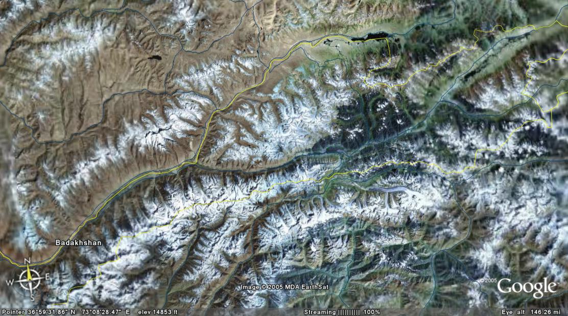
GoogleEarth provides useful satellite imagery of the whole region. See here.
Österreichischen Alpenverein (Alpenvereinskarte) publishes the following maps:
- Darrah-e Issik-e Bala (Upper Issik Valley & Koh-e Pamir peak) Glacier Map. 1:25,000. 1975.
- Koh-e Pamir. 1:50,000. 1975.
- Pamir-e Wakhan, Dardistan Geologic Map. 1:250,000. 1975. Geological map of the Selsela Koh-e Wakhan (Pamir-e Wakhan) and parts of the High Hindu Kush, Hindu Raj and Western Karakoram. No elevation information on this map.
These maps may be purchased from The Map Shop or Omnimap.
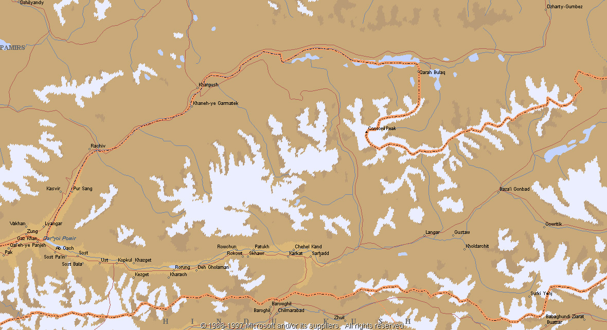
Map by Microsoft Encarta may be found here. Another map here (pdf).